Israel–Syria
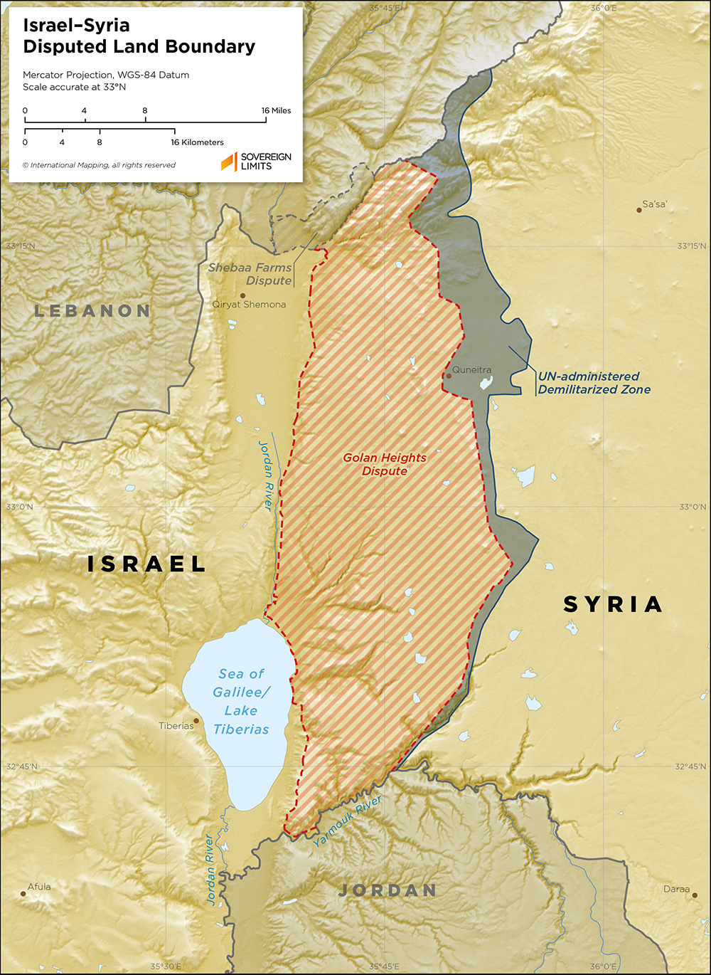
The land boundary between Israel and Syria has a long and complicated history. Its modern form has its roots in the colonial period, as established by a 1923 delimitation agreement between the British (Mandatory Palestine) and the French (Mandate for Syria and Lebanon). With the end of the colonial period, conflict between the newly independent neighboring States began with the First Arab–Israeli War in 1948 in which Israel fought against most of its neighbors, including Syria. The conflict ended with an armistice agreement, signed in 1949, and one of the components of the ceasefire was a demilitarized zone along the border between Israel and Syria.
Instability in the region persisted and several additional Arab–Israeli wars followed. Golan Heights, a strategic plateau located in Syria to the east of the Jordan River, was occupied by Israel in 1967 and remains an area of contention between the two States. In 1974, another disengagement agreement was signed by Israel and Syria, which defined another demilitarized zone, this one to the east of Israeli-occupied Golan Heights. The United Nations Disengagement Observer Force (UNDOF) was established to administer the demilitarized zone. Despite international protest, Israel unilaterally annexed Golan Heights in 1981.
The entirety of the international boundary between Israel and Syria remains disputed. Israel occupies Golan Heights, to which Syria maintains its claim. In late 2024, as the Syrian civil war came to an end, Israeli forces moved further into Syrian territory to occupy several areas within the UNDOF-managed buffer zone. Syria and Israel have attempted to negotiate a security agreement since the Syrian regime change, but progress has stalled due to the general instability in the region.
$20.00Add to cart