France (New Caledonia)–Solomon Islands
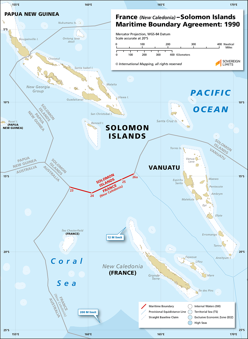
In 1990, France (on behalf of New Caledonia) and the Solomon Islands agreed to establish a maritime boundary in the Coral Sea that, tip-to-tip, spans 275 nautical miles. The boundary was delimited using the principle of equidistance, and it was composed of two terminal points and two interior turning points. The boundary begins at a western tripoint with Australia and follows a generally eastward bearing before ending at an eastern tripoint with Vanuatu.
The basepoints that controlled the plotting of the equidistance line were located on South Reef for the Solomon Islands, and on the northernmost point of the Indispensable Reefs for New Caledonia. Two basepoints were used for New Caledonia: one located on the Récif d’Entrecasteaux and the other on Récif Bampton of the Iles Chesterfield.
$5.00Add to cart