Lithuania–Russia (Kaliningrad)
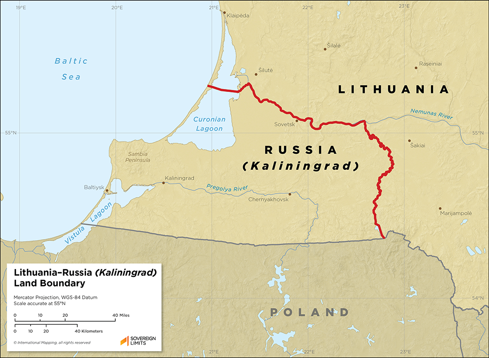
Since the dissolution of the Soviet Union in 1991, the Republic of Lithuania has shared a land boundary with the Russian Federation’s exclave of Kaliningrad. The frontier between Lithuania and Kaliningrad runs for 273 kilometers (170 miles) from the Baltic Sea in the northwest to a tripoint with Poland in the southeast.
Throughout the early twentieth century, Lithuania’s status as an independent state was highly contentious and the subject of multiple treaties and conflicts. Lithuania would ultimately become a Union Republic of the Soviet Union in 1940, while present-day Kaliningrad fell under Russia’s control following World War II. This would lead to the eventual establishment of an internal Soviet border between Lithuania and Kaliningrad.
Beginning in the late 1980s, Lithuania began to reject what it perceived as foreign, Soviet control over the country, eventually declaring its independence in 1990 as the Republic of Lithuania. Since then, there have been no disputes reported over the alignment of the border. The Russian Federation and Republic of Lithuania have worked to properly delimit and demarcate the border and have further defined it by officially establishing a tripoint with Poland. While the location of the border has remained undisputed, Lithuania has continued to develop security infrastructure along its frontier with Russia and Belarus in response to recent military and immigrant influxes.
$15.00Add to cart