Honduras–Nicaragua
The land boundary between Honduras and Nicaragua spans the Central American Isthmus, and thus the two States have land boundary termini (LBTs) in the Caribbean Sea and in the Gulf of Fonseca. For Honduras, whose coastline in the west is confined to the Gulf of Fonseca, it also has maritime claims extending into the Pacific Ocean.
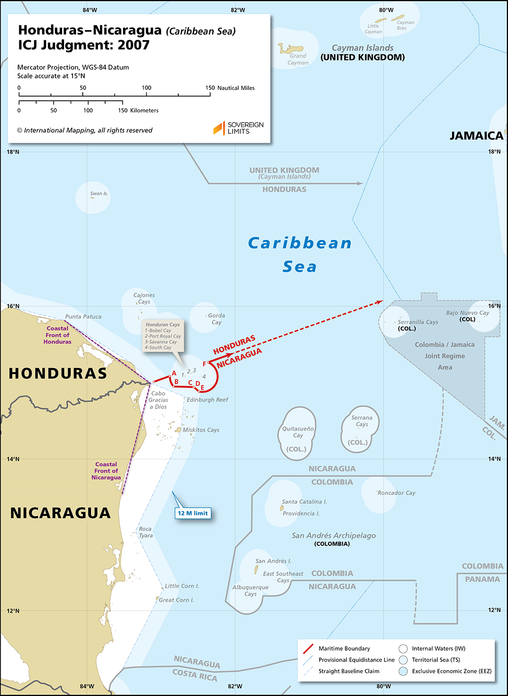
In the Caribbean, the maritime boundary between Honduras and Nicaragua was established by an International Court of Justice (ICJ) Judgment handed down in 2007. Here, the LBT was positioned in the mouth of the Río Coco, which the Court found to be highly unstable and, therefore, elected to start the maritime boundary three nautical miles offshore. For the most part, the boundary is a bisector line that advances seaward on a directional bearing from true north of 70° 14′ 41.25″ E. This directional bearing was interrupted nearshore to semi-enclave four tiny Honduran islets located near Cabo Gracias a Dios. This carve out was composed of two twelve nautical mile (M) territorial sea segments and a brief section of equidistance.
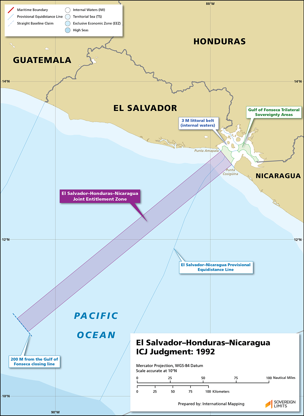
In the west, the Pacific Ocean maritime boundary has yet to be fully defined. In a 1992 ICJ Judgment between El Salvador and Honduras, with Nicaragua intervening, the Court established a closing line for the Gulf of Fonseca, declaring the territory within to be joint internal waters. Beyond the gulf, the three States were to have “entitlement to territorial sea, continental shelf and exclusive economic zone seaward of the central portion of the closing line.” The Court did not define any maritime boundaries, and the three States have yet to come to an agreement on Pacific Ocean maritime boundaries.
In 2021, Honduras and Nicaragua signed a bilateral agreement reaffirming the decisions of the ICJ in 1992 and 2007. The two States updated the location of their LBT in the Río Coco but did not specify how the land boundary would connect with the starting point of the maritime boundary. The Agreement also verified the location of the Gulf of Fonseca closing line and proposed a potential corridor for Honduran access into the Pacific Ocean. El Salvador would be needed to finalize such a boundary and, for its part, has so far rejected the 2021 Agreement.
$20.00Add to cart