Equatorial Guinea–Gabon
In November 2016, Gabon and Equatorial Guinea submitted a dispute over the existing legal titles related to the delimitation of their land and maritime boundaries to the International Court of Justice. The Court issued its judgment on 19 May 2025. Central to the conflict was the validity of a 1974 “Convention Demarcating the Land and Maritime Frontiers of Equatorial Guinea and Gabon” or “Bata Convention,” which Gabon claimed was in force between the Parties and defined both the land and maritime boundaries. The Court found that the “Bata Convention” was not a legal title and that the only valid boundary delimitation between the two States was the “Special Convention on the Delimitation of French and Spanish Possessions in West Africa, on the Coasts of the Sahara and the Gulf of Guinea” signed by France and Spain on 27 June 1900. None of the subsequent colonial era boundary demarcation efforts or agreements were found to be valid legal titles by the Court. The Court was not asked by the Parties to delimit the boundary between them, and it did not do so.
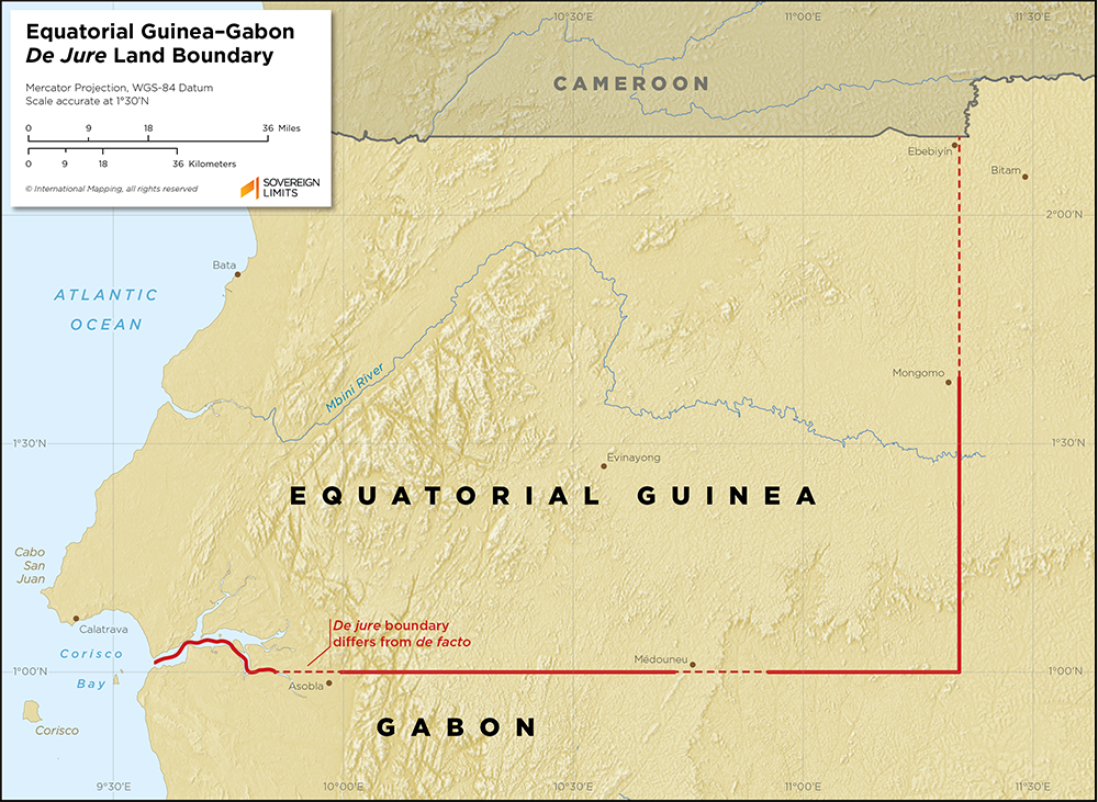
The boundary between Río Muni, the continental part of Equatorial Guinea, and Gabon as defined in 1900 by the colonial powers begins in Corisco Bay in the southeastern Gulf of Guinea and follows the thalwegs of the Muni Estuary and Utamboni River. It then follows the 1° N parallel eastward before turning north along the 11° 20′ E meridian, which corresponds with 9° E of Paris from the original Convention, before reaching the tripoint with Cameroon.
This version of the boundary differs from the reality on the ground in a few key places, namely Asobla, Médouneu and Ebebiyín. Equatorial Guinea and Gabon will now need to negotiate modifications to the historic, colonial-era boundary.
$15.00Add to cart