Australia–Papua New Guinea
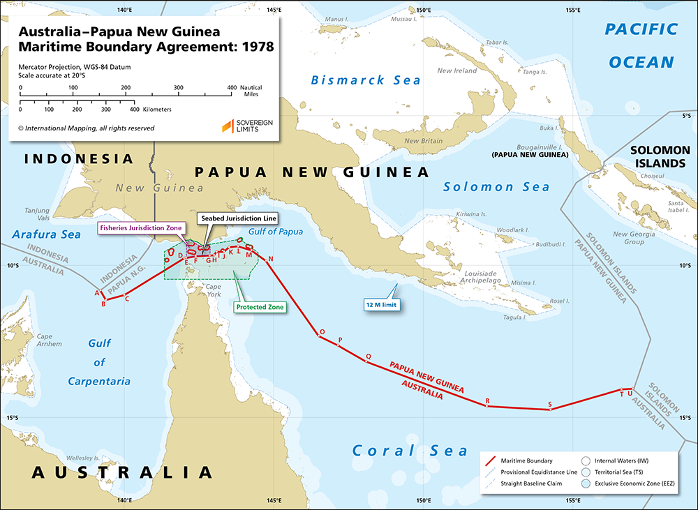
On 19 December 1978, Australia and Papua New Guinea signed a maritime boundary agreement that took over six years of negotiations to establish. The maritime frontier is complex, and the Agreement established four different maritime boundaries. These included boundaries for the territorial sea and seabed jurisdiction, along with a fisheries jurisdiction zone and a protected area for Torres Strait islanders.
Beginning in the Arafura Sea, the boundary delimited the seabed jurisdiction zone and fisheries jurisdiction zone with an equidistant line. The boundary then proceeds into the Torres Strait where the fisheries jurisdiction zone diverges, meaning it does not align with the territorial sea and seabed jurisdiction boundary. To the east of the Torres Strait, the territorial sea boundary passes through several islands out into the Coral Sea before ending at Australia’s boundary with the Solomon Islands. In total, the maritime boundary extends for 1,234 nautical miles.
$10.00Add to cart