

Papua New Guinea–Solomon Islands
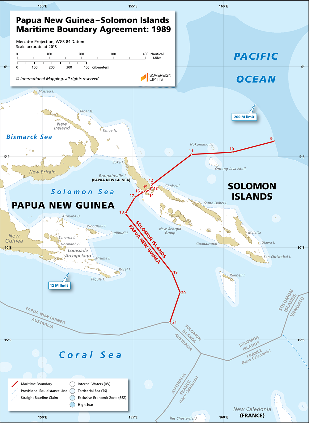
The maritime boundary between Papua New Guinea and the Solomon Islands was delimited by an agreement that was reached in 1989. The Agreement established a comprehensive boundary that delimited the territorial sea, exclusive economic zone and continental shelf entitlements of the Parties, and it traversed parts of the Pacific Ocean, Solomon Sea and Coral Sea for 1,005 nautical miles. In addition, the 1989 Agreement covers the exploitation of cross boundary mineral deposits, the regulation of fisheries and other living resources, the protection of the marine environment, the search and rescue processes, the protection of traditional means of livelihood, and the settlement of disputes.
Beginning at Point 9, the boundary starts north of the Solomon Islands and heads in a westerly direction before proceeding to the southwest through the Bougainville Strait. The maritime boundary reaches the Solomon Sea and continues in a southeast direction before stopping just short of maritime areas where Australian entitlements would come into play. The Agreement has yet to enter into force due to issues over the surveys used during the delimitation process and where the tripoint with Australia will be located.
$5.00Add to cart